Independent project · 2026
Tosker
A shared map for
going together.
Trips with friends gave me a question I couldn’t put down: what would a map look like if the group was the starting point?
I designed and built Tosker to bring places, plans and conversations into the same shared space.
Explore the product
Places to go. People to go with.
The personal starting point
The route was easy.
The together part wasn’t.
I travel a lot with friends. We could find directions in Google Maps or Waze, but the way we used those tools never quite fit how we planned and moved as a group.
Choosing the next stop, keeping a shared plan and knowing what everyone meant still felt like separate jobs. I wanted a place where the map and the conversation could stay together.
That became Tosker. Group movement was the ambition. Collaborative planning became the foundation I could build, test and refine first.
The working product
Let the place hold
the conversation.
The Map is the workspace. Chat and Board come alongside when needed, while the route and its places stay in context.
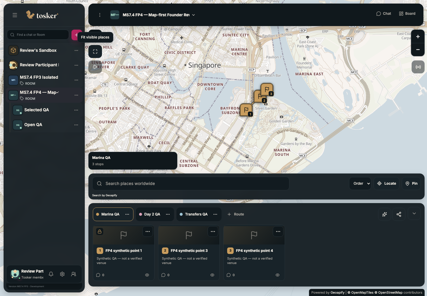
Map
Find a place, preview it and explicitly add it. Arrange stops into routes and keep saved places beyond a single itinerary.
Chat
Discuss the trip beside the Map. Opening, closing or switching panels preserves the conversation and the draft.
Board
Keep plans and notes that need to outlast the chat stream in a shared companion panel.
 Ratatoskr → Tosker
A name with somewhere to go
A small connector
between worlds.
Tosker is shortened from Ratatoskr, the squirrel that travels along Yggdrasil, the world tree in Norse mythology, carrying messages between its inhabitants.
I took that movement between worlds as a metaphor for connection: between people, between places, and between an idea for a trip and actually going together.
The faceted squirrel gives the identity a compact, recognisable silhouette. Warm gold and an expressive serif wordmark bring character to the dark interface; the restrained geometry carries through to pins and rounded panels.
The myth’s messenger is mischievous. The idea of a helpful connector is Tosker’s interpretation. Source: Gylfaginning, XVI.
Designing what stays
A place is bigger
than one itinerary.
A saved Map Pin and a Route Location have different jobs. A pin remembers the place. A Location Card belongs to a particular route. Adding a pin to a route creates a new card; removing either doesn’t erase the other.
Map Pin states, shown here as an editorial summary of the implemented model.
Private visibility, shared decisions.
Hide affects my Map. Skip affects the shared route. Keeping those actions separate makes the consequence clearer to everyone.
Deleting should feel different.
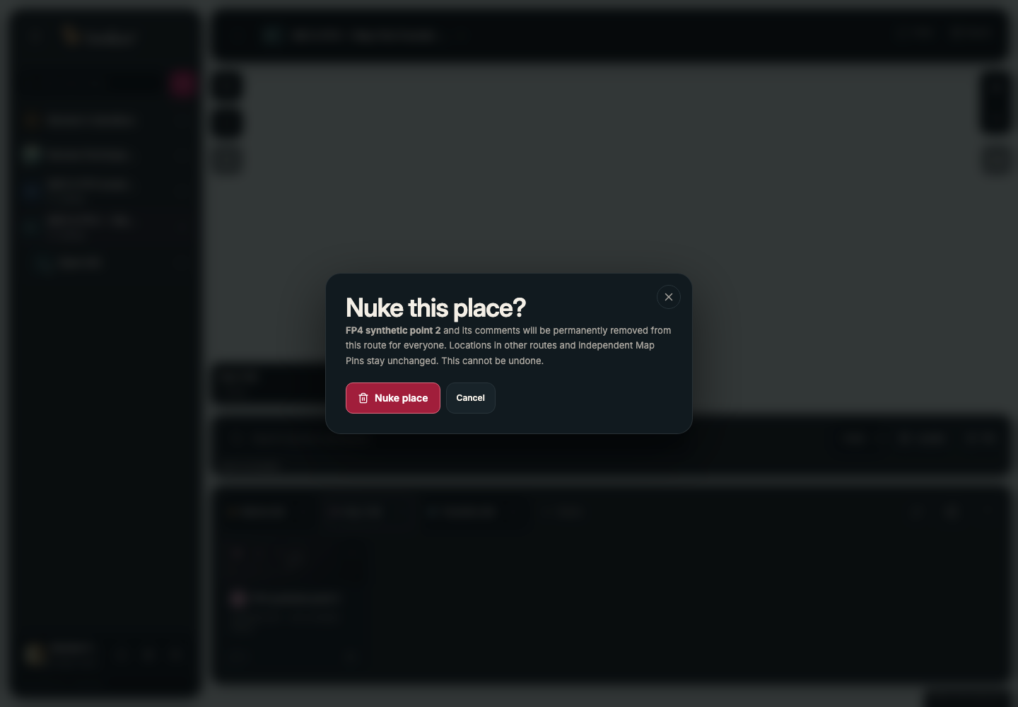
“Nuke” names the place, explains who is affected and asks for confirmation. Its red treatment separates a permanent action from everyday edits.
The details that earn trust
Together, by choice.
Location is useful—and personal. Locate starts with a private view. Sharing requires a clear audience and an explicit choice: broad area, precise position, or Keep private.
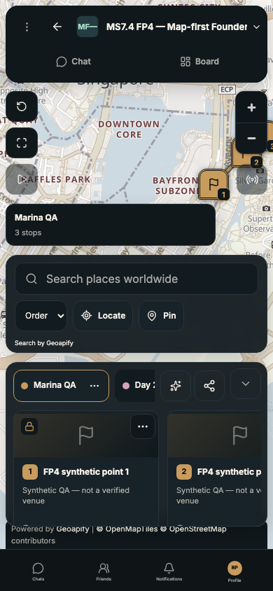
The trip on a smaller screen
The same Map, search and route hierarchy at 390 pixels, with companion panels within reach.
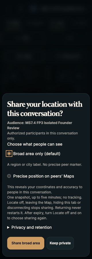
Consent before coordinates
The FP3 consent flow retained into FP4: one manual snapshot, up to five minutes, with a separate choice for precise sharing.
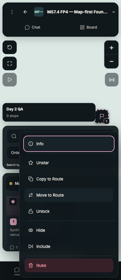
A smaller set of actions
Eight purposeful actions with a distinct destructive choice. This isolated interaction test uses an offline basemap.
Sharing has an end.
Stop Sharing, expiry and loss of access remove the shared view. There is no continuous or background tracking in this version. Temporary server state has a deletion workflow; database recovery retention is disclosed separately, rather than described as instant erasure everywhere.
From design to a working beta
The interface was only
half the work.
I worked across the identity, interaction model and implementation, using AI-assisted development to turn the product decisions into a working application.
The foundation uses Next.js and TypeScript, MapLibre for rendering, Geoapify behind a replaceable provider boundary, Clerk for identity, Neon for persistence and Ably for realtime updates.
Separate test accounts exercised shared state and access boundaries. Responsive checks, reconnect behaviour, consent expiry and deletion checks became part of release acceptance—not just the appearance of a successful screen.
The most important lesson: a shared map needs to explain ownership as carefully as it explains geography. People need to know what is theirs, what changes for the group and what disappears when they leave.
A deliberate pause
The next trip can wait.
In November 2026, I paused Tosker to settle into work. This case study preserves the brand, the working beta and the decisions behind it.
The completed foundation brings shared planning, conversation and optional location snapshots together. Continuous group movement and voice/video remain future directions. The beta is a personal development project, not a finished navigation service.